The Simtable Evacuation Module creates agent-based models of your local populations. Each household on the map can display multiple vehicles, probability of occupancy and number of residents. Demographics can also include retiree, tourist/visitor, and school-aged populations. These demographics can impact driver behavior concerning knowledge of road networks, need to coordinate trips and emergency notification communication patterns.
Agent drivers navigate the road network based on their knowledge of the incident and of the roadways. Our approach allows for emergent congestion patterns and heterogeneous driver behavior. Similar models can be adapted for pedestrian evacuations from special events, festivals, and large sporting matches.
Let Simtable create custom traffic models to help you with your public safety evacuation planning.
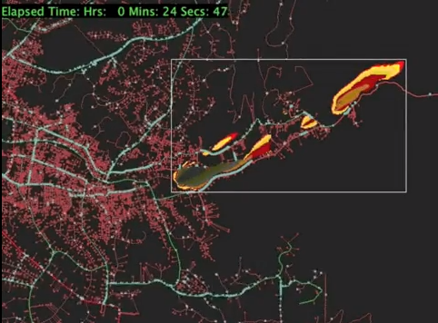
- See traffic flows in relation to fire simulations and the time of their progression
- Locate potential traffic congestion points
- Identify key escape routes and plan for resource allocation
- Use population modeling to estimate vehicle & foot traffic
- Integrate rich real-time data with remote sensor gathering
Fire and Evacuation Model, Cerro Gordo, Santa Fe, NM
Crowd Evacuation for community event, Zozobra, in Santa Fe, NM