Evacuations
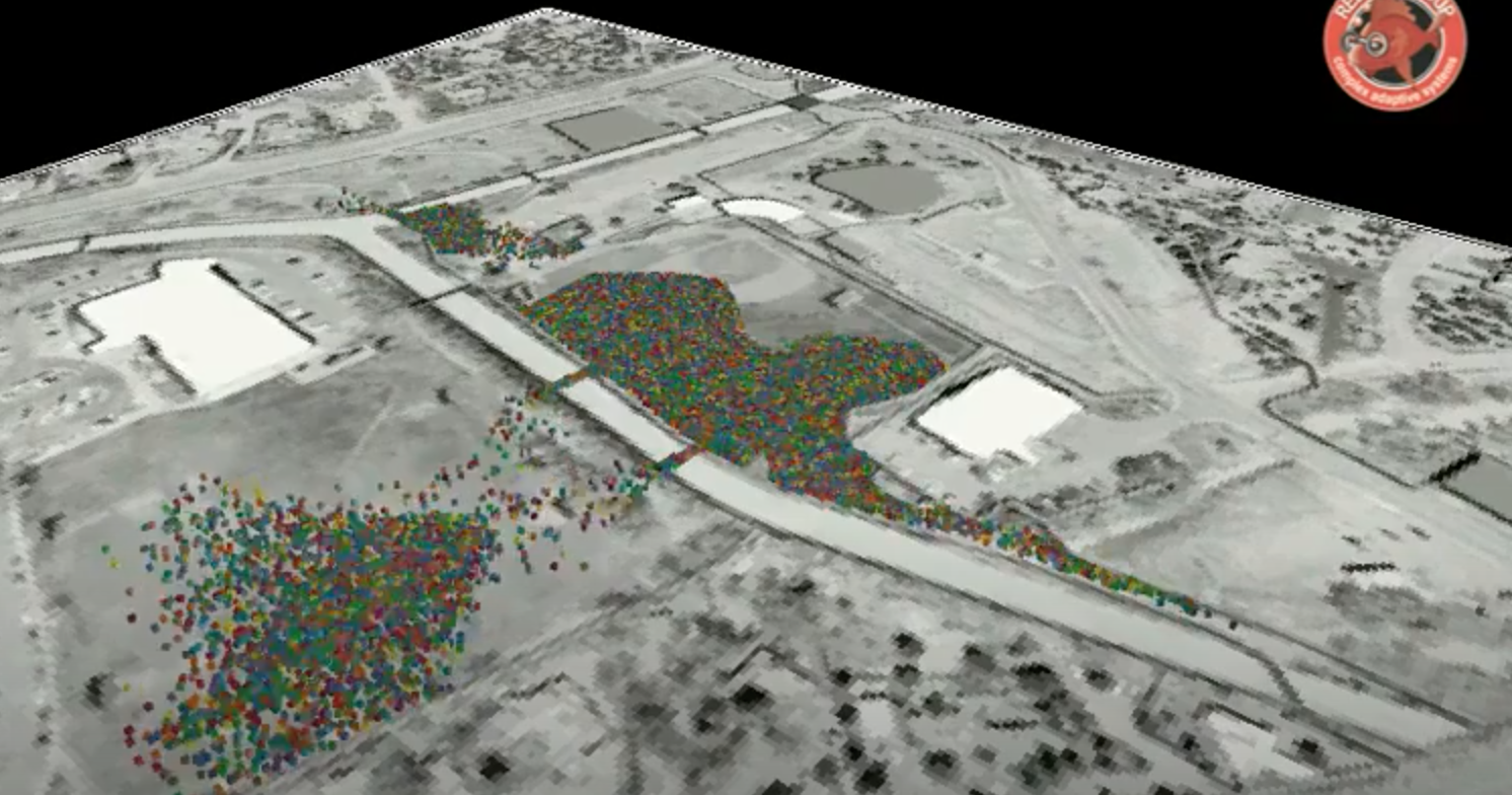
Simtable’s Evacuation Module creates agent-based traffic models of your local populations. Our approach allows for users to visualize traffic in their areas of interest, set evacuation zones and discover the congestion patterns that emerge.
Data on households can be used to spawn traffic using the probability of occupancy, number of residents and number of household vehicles. Demographics can include local retiree, tourist/visitor, and school-aged populations. These demographics can impact driver behavior with regard to their knowledge of road networks, the need to coordinate trips, and emergency notification communication patterns. Agent drivers navigate the road network based on their knowledge of the incident and of the roadways.
Similar models can be adapted for pedestrian evacuations from special events, festivals, and large sporting matches. Let Simtable create custom evacuation models to aid in your public safety evacuation planning.
- See traffic flows in relation to fire simulations and the time of their progression
- Locate potential traffic congestion points
- Identify key escape routes and plan for resource allocation
- Use population modeling to estimate vehicle & foot traffic
- Integrate rich real-time data with remote sensor gathering from your GIS sources
Users now have the ability to add traffic to their scenarios, add evacuation and destination areas, set their ‘ready, set, go’ status, create and load evacuation area templates, and visualize how evacuation areas impact traffic on the road networks.